Tutorials
Bayesian Modelling and Probabilistic Programming with Numpyro, and Deep Generative Surrogates for Epidemiology
This tutorial explores Bayesian modeling topics using NumPyro, covering inference, hierarchical models, spatial Gaussian processes, ODEs, and agent-based models for disease transmission.
Intro to GIS with Python
This step‑by‑step tutorial introduces geospatial data analysis using Python and open‑source tools, covering GIS fundamentals, map visualization, and spatial operations.

Learning with Temporal Point Processes
This tutorial introduces the theory of temporal point processes, reviews key types, and explores their role in modern ML models and control algorithms. It also covers recent advances in deep learning and Bayesian nonparametrics.

NYC Motor Vehicle Collisions
This tutorial analyzes NYC collision data with heatmaps and time‑series plots to reveal temporal and spatial crash patterns, informing safety and planning.
https://www.kaggle.com/code/skhiearth/nyc-motor-vehicle-collisions
Neural TPP Model
This tutorial introduces Neural Temporal Point Processes, explaining how to parameterize TPPs with neural networks, derive their likelihood function, and train models in PyTorch using the corresponding loss.
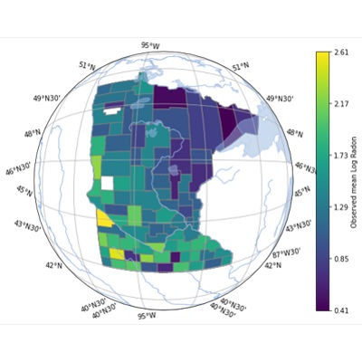
PyMC Spatial GP
This PyMC Labs tutorial shows how to model spatial data using Gaussian Processes in PyMC, covering spatial kernels, latent GPs, and posterior predictive checks, which are valuable for applications in geostatistics, epidemiology, and environmental modeling.
https://www.pymc-labs.com/blog-posts/spatial-gaussian-process-01/
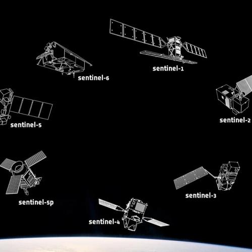
Sentinelsat Package
This tutorial explores the use of the Sentinelsat Python package for using different satellites for retrieving various forms of data, such as all weather data, land-surface temperature, and ocean color and land color with longitude and latitude locations.

Working With Spatio-Temporal Data in Python
This tutorial introduces Python for analyzing and visualizing spatial-temporal data. And uses datasets from the environmental sciences that are freely available.